Biology Program
The Ute Mountain Ute Tribe’s Biology Program aims to address the conservation needs of sensitive and tribally important species and landscapes on Ute Mountain Ute tribal lands through research, monitoring, conservation planning, and habitat enhancement. Ongoing efforts include:
Research Initiatives
Pinyon-Juniper Woodland Resilience
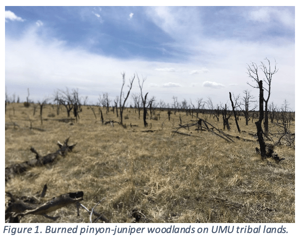 We partnered with the U.S. Geological Survey and Northern Arizona University to study pinyon-juniper woodland resilience in the context of wildfire, fuels management, and climate change. The goals of this study are to address:
- How does a holistic understanding of the ways thinning and fire affect PJ woodlands offer improved management options?
- What innovate restoration techniques can restore pinyon-juniper communities following fire in the face of climate change?
Results from this project will assist BIA and tribal natural resources managers decide which thinning techniques offer effective and ecologically beneficial protection against large-scale wildfires, and how to restore pinyon-juniper woodlands that have already burned.
RestoreNet Rangeland Restoration
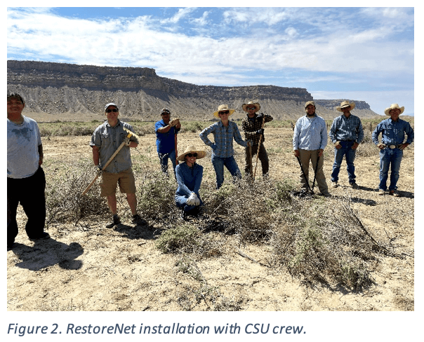 In fall 2021, we worked alongside Colorado State University, the CSU Extension, and CSU Agricultural Research Station to install a RestoreNet plot within the Mancos Canyon. RestoreNet is a distributed field trial network for dryland restoration, and involves testing both standardized and locally prescribed restoration techniques in arid landscapes. Restoration and revegetation in the arid southwest is challenging, and often unsuccessful. This 10-year study will help us answer:
- What is preventing the reestablishment of native vegetation following restoration seeding: are seeds not germinating, or are plants not surviving?
- Which restoration techniques can we use to improve degraded rangelands on Ute Mountain Ute Tribal lands?
We are actively working with CSU to scale-up this research using preliminary results to test methods at a larger scale on Tribal lands in order to improve degraded rangelands.
Big Game Survey Methods
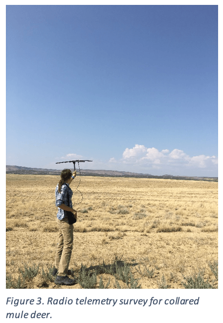
We are working with Wildlands Network to gather baseline data on big game populations and develop low-cost survey protocols to capture demography, abundance, and distribution of big game species annually. Current standardized techniques (e.g., aerial survey and GPS collars) are expensive and Tribes are often left without the ability to perform regular monitoring. Our goal is to determine:
- How can low-cost monitoring techniques such as drive counts, drone counts, and camera trapping be used to collect scientifically robust data from which we can make management decisions?
- How effectively can these techniques be implemented in remote areas where seasonal road conditions often limit access during winter concentration?
Results from this project will be presented to the Brunot Wildlife Department and Hunting Commission to inform their management decisions related to big game hunting regulations.
Monitoring
Sensitive Plant and Wildlife Monitoring
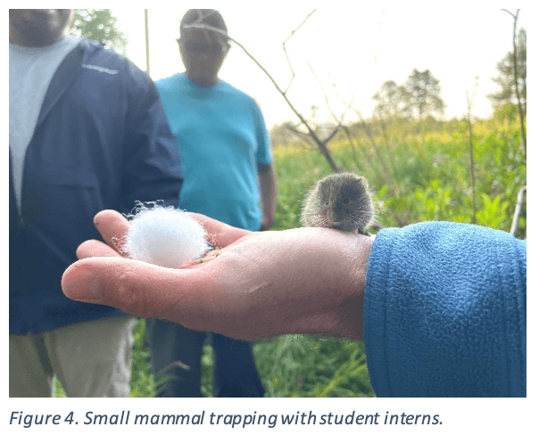 Tribal Biology Program staff conduct strategic surveys and monitoring for numerous sensitive plant and wildlife species.
Since 2019, we have established long-term monitoring for three rare plant species: Mesa Verde cactus (Sclerocactus mesae-verdae), Sleeping Ute milkvetch (Astragalus tortipes), and Chapin Mesa milkvetch (Astragalus schmolliae). Data are used to assess population trends and drivers, and will be used to inform the conservation planning process.
We also conduct surveys and monitoring for rare and sensitive wildlife, including sage grouse, migratory birds, desert fish, and small mammals. Data are used to assess presence/absence of sensitive species on Tribal lands, inform best management practices for land management, and inform habitat and conservation planning.
Big Game Drive Counts
Drive counts are being conducted to gather baseline data on big game, including mule deer, elk and pronghorn. Though there are inherent flaws associated with drive count methods for monitoring big game (e.g., double counting, road bias, etc.), we hope to learn more about the seasonal distribution and demography of big game species as a result of this monitoring effort.
Post-Restoration Project Monitoring
Vegetation monitoring is conducted annually for a period of time following habitat restoration, and is typically conducted using line point intercept transects with repeat photography to document the condition of the vegetation community following restoration. Results are used to measure project success and inform future restoration efforts.
Habitat Enhancement
Mancos Canyon
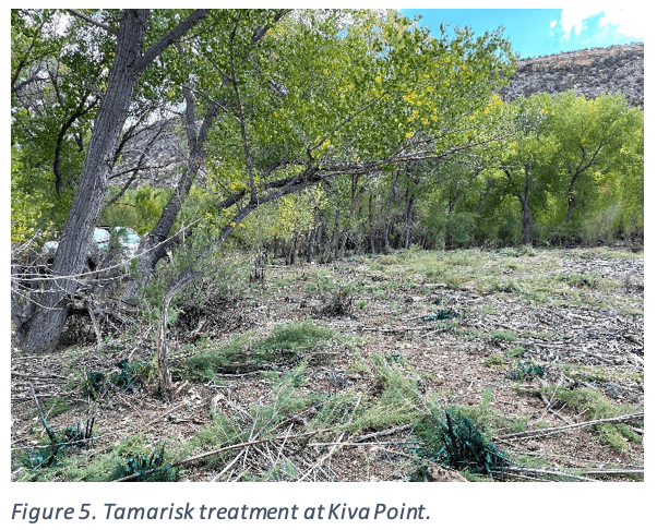 Riparian areas across the southwest U.S. are being lost at an alarming rate, and over 80% of wildlife depend on riparian areas at some stage during their lifespan. In the Mancos Canyon, riparian woodlands are important wildlife habitat, and provide a source for cultural cottonwood harvest.
We are working hard to remove invasive tamarisk from the Mancos Canyon and revegetate treated areas with native plants to support wildlife habitat and create a sustainable resource for harvesting cottonwood for traditional use. Other objectives include addressing bank erosion and channelization along the Mancos River to improve water quality and quantity. Partnerships with many organizations, such as Trees Water and People, Mountain Studies Institute, the Mancos Conservation District, Mancos Watershed Group, Colorado Partners for Fish and Wildlife, and others have helped us further our goals for habitat restoration in the Mancos Canyon.
Pinecrest Ranch Mesic Meadows
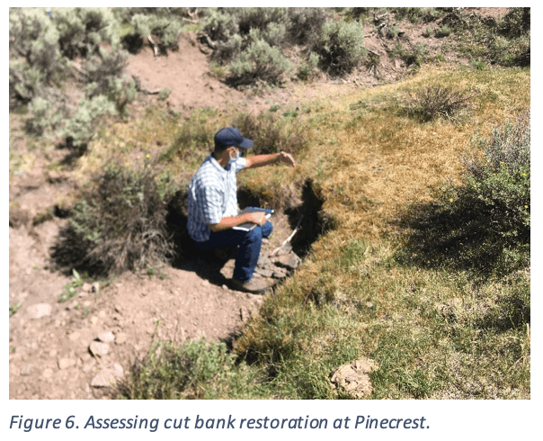 The Tribe’s summer cattle pastures at Pinecrest Ranch are home to all life cycles of Gunnison sage grouse (Centrocercus minimus). During the summer months, when grouse are raising their chicks (“brood-rearing”), they frequent mesic meadows that are high in insect production.
Mesic areas at Pinecrest are shrinking as a result of poor hydrologic functioning. Channelization and a lowering water table has facilitated sagebrush encroachment into historic meadows, and will likely end in a transition from perennial waters becoming intermittent.
We are partnering with Colorado Parks and Wildlife, Natural Resources Conservation Service, Upper Gunnison River Water Conservancy District, and U.S. Fish and Wildlife Service to restore mesic meadows using low-tech rock structures to slow down and spread out water, aggrade the channel, and maintain or expand the “green zone.”
Conservation Planning
Wildlife and Habitat Management Plan
We are working through Natural Resources Conservation Service’s EQIP program to develop fish and wildlife habitat management plans for each of the range units within the reservation boundary. Each plan will outline specific conservation practices that can be used to improve fish and wildlife habitat, and will support a comprehensive wildlife and habitat management plan for Ute Mountain Ute tribal lands.
Rare Plant Management Plan
Ute Mountain Ute tribal lands are home to at least five rare plant species, which we intend to develop conservation plans for in a comprehensive Rare Plant Management Plan. So far, a conservation plan for the Chapin Mesa milkvetch (Astragalus schmolliae) has been approved by tribal council.
